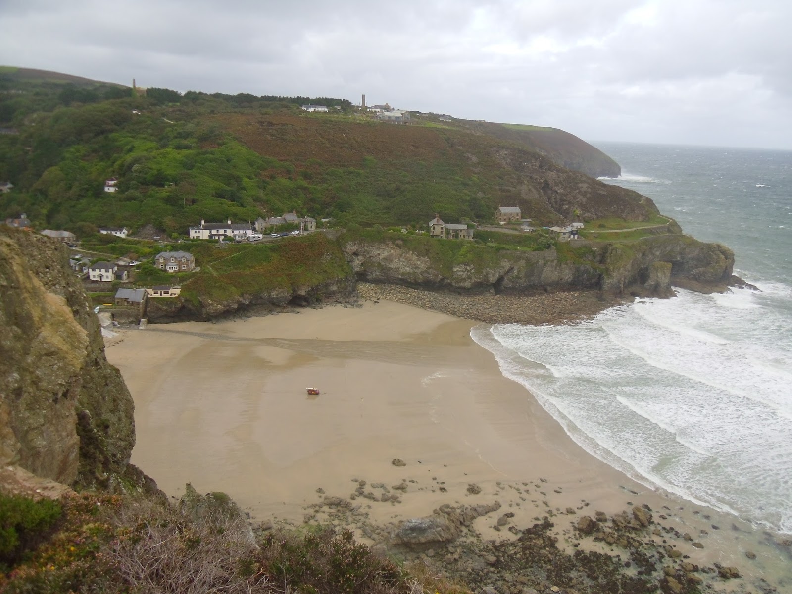
There were a few parked few cars and hardy dog walkers when I reached the cove at Chapel Porth. Also another RNLI vehicle with a red flag, the driver keeping watch. To my relief the frequency of the showers was already decreasing, but not the strength of the wind. Foam was blowing off the sea here, big clumps of it flying through the air at speed, a sight I'd see often today.
North of Chapel Cove my mind was taken off the weather by the iconic abandoned mines of Wheal Coates, a fascinating place well worth a visit. I stuck to the official coast path which goes right next to the Towanroath engine house. It is incredibly well preserved despite being closed since 1889. It comes as no surprise to learn this is a Grade II listed building. Apparently it's also the most photographed mine in Cornwall and is often used in promotional material.
Moving on again the skies seemed to be brightening-up but the wind was growing even stronger. The gusts were particularly fierce on St.Agnes Head where it was hard to stand up, breathing wasn't easy either. I saw another long-distance walker for the first time today here. A gentleman with a large red beard heading the other way. If the wind was blowing off-shore I'd have considered postponing today's walk, but it didn't feel too dangerous being blown towards the land.
As I continued there was more isolated rugged coast to enjoy. I saw a natural arch at Polberro Cove on my approach to St.Agnes. At Trevaunance Cove the RNLI lifeguard had erected yellow and red flags, there were two brave surfers in the waves. They would turn out to be the only people I'd see in the sea all day. After the steep climb up out of Trevaunance Cove I made my way down an equally steep descent towards more old mines. At the bottom I was reminded by the gate that this hill, known as Blue Hills, belongs to The Motor Cycle Club. Amazingly to this day it still forms part of the route of their annual London to Lands End Trial. On Youtube you can find footage of people driving various vehicles up this crazy hill.
After another steep climb I came to the cliff-top at Cross Combe next to the old airfield. Here I saw something I'd never seen before, a waterfall going upwards. The strong wind was turning the falling water into a fine spray and blowing it all back over the top of the cliff, none of it was making the bottom. I took photographs, but they don't really show what was happening. As I walked on along the cliff-top I passed through the misty spray.
At Cligga Head I saw the remains of yet more extensive mines, they seemed to be everywhere now. While occasional showers were still falling they were now less frequent than I'd expected. I later learned the main band of rain had moved just north of Newquay. Another coast walker in that area heading south was getting it much worse than me. The huge beach at Perran Sands, a wonderful sight, came into view. I dropped down into Perranporth where Lea was waiting for me in the car park with a delicious lunch.
In 2010 I walked along Perran Sands. The tide was out again today, but this time I decided to stick to the official coast path through dunes of Penhale Sands and enjoy the view from above. This beach is huge, magnificent, surely one of the finest in England. It was almost deserted today. From Perran Sands around to Holywell Bay via Ligger Point and Penhale Point the path was fascinating and spectacular. There are rugged coves and high cliffs, crashing waves and much white surf being generated by the strong wind. You see old mine shafts frequently along here, also weird MOD installations that are part of Penhale Camp.
The path goes through huge dunes at Holywell Bay. Last time I stuck to the beach, this time I managed to follow the official route. It wasn't easy going up and down with soft sand underfoot, but great fun nonetheless. There were signs warning walkers to watch out for adders basking in the sun. I kept half an eye out, but seeing as I came through a few minutes after a shower I thought it was unlikely I'd see any.
There was a lovely inlet at Porth Joke. As I took pictures there of an island known as 'The Chick' I could see the next shower blowing in. It dropped a fair bit of rain on me as I approached Crantock Beach. I didn't mind because however because it also rewarded me with a fantastic double rainbow which I managed to capture in pictures and a video.
I'd researched the tide times in advance so knew I wouldn't be able to cross The Gannel via the Fern Pit tidal bridge. I also knew the ferry doesn't operate in adverse weather, so I didn't waste time looking for it and instead headed straight for the second tidal bridge slightly further inland at Penpol Creek. I got there just in time and crossed over to Newquay carefully with rising water lapping around my boots.
The showers had dried up by now, in some late afternoon sunshine there were plenty of people out for a stroll at Fistral Beach. It's well known as a surfing location, but with red flags still flying today the water was empty. I made my way around the imposing Headland Hotel and past Huer's Hut. It's easy to forget Newquay has a pretty harbour and working fishing boats, I enjoyed views of it from above. I followed the path through the town centre as far as our B&B near the railway station.
My route today had been truly magnificent. Despite the weather being a bit awkward at times it seems incredible to me that you can see so many wonderful, varied places in only 20 miles of coast walking.
Distance Walked Today 20.19 miles (32.49km)
Walking Time; 6 hours 28 minutes
Average Walking Speed 3.1 mph
Cumulative Distance Walked 472.89 miles (761.04km)
GPS Track; https://runkeeper.com/user/GaryQQQ/activity/655914623
 |
| Leaving Porthtowan in stormy weather, the RNLI keeping watch |
 |
| Chapel Cove, rocks covered in sea foam |
 |
| The Towanroath engine house at Wheal Coates |
 |
| Natural arch at Polberro Cove |
 |
| Trevaunance Cove, St.Agnes, there are two surfers in the water somewhere |
 |
| The Motor Cycling Club gate at the bottom of Blue Hills |
 |
| Arriving at Perranporth |
 |
| View of Perran Sands from Kelsey Head |
 |
| Wild seas between Ligger Point and Penhale Point |
 |
| Crossing the huge dunes behind Holywell Bay |
 | ||
| A shower approaches as I photograph Porth Joke and The Chick
|

 |
| The tidal bridge I used to cross The Gannel |
 |
| Fistral Beach, Newquay |
 |
| Newquay harbour |
No comments:
Post a Comment